Information about YURAYGIR National Park
| FACILITIES AVAILABLE IN THIS PARK as known March, 2007" |
           
|

|
| FACILITIES AVAILABLE IN THIS PARK as known March, 2007" |
|
|
|
|
|
|
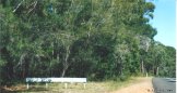
Yuraygir National Park is located on the coast to the south of Yamba and to the east of Maclean.
This park contains pristine beaches, lagoons, swamps and heathland. The creeks and rivers within the park are ideal for canoeing and plenty of bushwalks, including the 10Km Angourie Coastal Walk, are avaialble for the visitor. The park actually contains the longest stretch of undeveloped coastline in New South Wales.
For additional information on Yuraygir National Park just follow the link.

|
Two views of the Yuraygir National Park. | 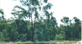
|

|
This site is maintained by a group of volunteers. We strive to do our best but sometimes things are overlooked. If you find things that you deem incorrect or if you know of things and links that could enhance this site, which is primarily a dedicated link site containing only basic information, then please EMAIL us (using the button to the right) so that we can include it. All assistance is greatly welcomed.
|

|
|